
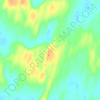
Thar Desert topographic map
Interactive map
Click on the map to display elevation.
About this map
Name: Thar Desert topographic map, elevation, terrain.
Average elevation: 88 m
Minimum elevation: 73 m
Maximum elevation: 110 m
Other topographic maps
Click on a map to view its topography, its elevation and its terrain.
Tanot
India > Rajasthan > Jaisalmer Tehsil
Tanot, Jaisalmer Tehsil, Jaisalmer District, Rajasthan, India
Average elevation: 107 m
Longewala
India > Rajasthan > Jaisalmer Tehsil
Longewala, Jaisalmer Tehsil, Jaisalmer District, Rajasthan, India
Average elevation: 106 m
Kanoi
India > Rajasthan > Jaisalmer Tehsil
Kanoi, Jaisalmer Tehsil, Jaisalmer District, Rajasthan, India
Average elevation: 203 m
Lodurva
India > Rajasthan > Jaisalmer Tehsil > Lodurva
Lodurva, Jaisalmer Tehsil, Jaisalmer, Rajasthan, India
Average elevation: 173 m
Loonar
India > Rajasthan > Jaisalmer Tehsil
Loonar, Jaisalmer Tehsil, Jaisalmer District, Rajasthan, India
Average elevation: 119 m