
Sarıgerme topographic map
Interactive map
Click on the map to display elevation.
About this map
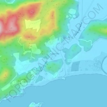
Name: Sarıgerme topographic map, elevation, terrain.
Location: Sarıgerme, Ortaca, Aegean Region, 48610, Turkey (36.69299 28.68364 36.73299 28.72364)
Average elevation: 85 m
Minimum elevation: -1 m
Maximum elevation: 450 m