
Kebri Dehar topographic map
Interactive map
Click on the map to display elevation.
About this map
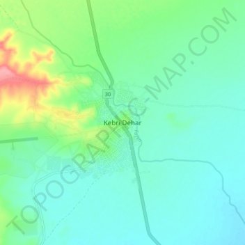
Name: Kebri Dehar topographic map, elevation, terrain.
Location: Kebri Dehar, Korahe, Somali Region, Ethiopia (6.69895 44.24041 6.77895 44.32041)
Average elevation: 521 m
Minimum elevation: 498 m
Maximum elevation: 597 m
Other topographic maps
Click on a map to view its topography, its elevation and its terrain.