
Hamble topographic map
Interactive map
Click on the map to display elevation.
About this map
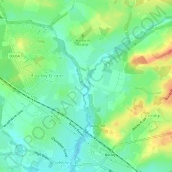
Name: Hamble topographic map, elevation, terrain.
Average elevation: 23 m
Minimum elevation: 5 m
Maximum elevation: 53 m
Other topographic maps
Click on a map to view its topography, its elevation and its terrain.
Fair Oak and Horton Heath
United Kingdom > England > Eastleigh
Fair Oak and Horton Heath, Eastleigh, Hampshire, South East, England, United Kingdom
Average elevation: 36 m
Knowle Park
United Kingdom > England > Eastleigh
Knowle Park, Fair Oak and Horton Heath, Eastleigh, Hampshire, South East, England, United Kingdom
Average elevation: 39 m
Knowle Hill
United Kingdom > England > Eastleigh
Knowle Hill, Eastleigh, Hampshire, South East, England, SO50 7NR, United Kingdom
Average elevation: 43 m