
Arugam Bay topographic map
Interactive map
Click on the map to display elevation.
About this map
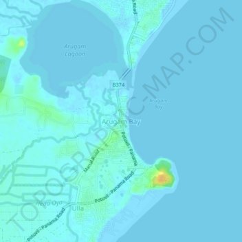
Name: Arugam Bay topographic map, elevation, terrain.
Location: Arugam Bay, Ampara District, Eastern Province, 32506, Sri Lanka (6.82662 81.81055 6.86662 81.85055)
Average elevation: 2 m
Minimum elevation: -2 m
Maximum elevation: 26 m
Other topographic maps
Click on a map to view its topography, its elevation and its terrain.