
Danderyds kommun topographic map
Interactive map
Click on the map to display elevation.
About this map
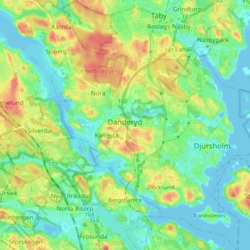
Name: Danderyds kommun topographic map, elevation, terrain.
Location: Danderyds kommun, Stockholm County, Sweden (59.36542 17.99131 59.44133 18.12249)
Average elevation: 19 m
Minimum elevation: -5 m
Maximum elevation: 55 m
Other topographic maps
Click on a map to view its topography, its elevation and its terrain.