
Khenchela topographic map
Interactive map
Click on the map to display elevation.
About this map
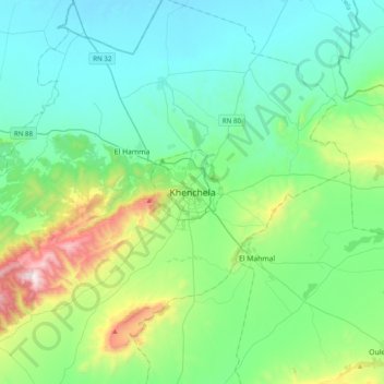
Name: Khenchela topographic map, elevation, terrain.
Location: Khenchela, Khenchela District, Khenchela, 4000, Algeria (35.27015 6.98571 35.59015 7.30571)
Average elevation: 1,098 m
Minimum elevation: 842 m
Maximum elevation: 2,095 m