
Tinian topographic map
Interactive map
Click on the map to display elevation.
About this map
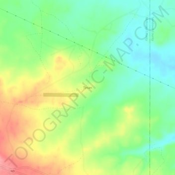
Name: Tinian topographic map, elevation, terrain.
Average elevation: 2,014 m
Minimum elevation: 1,975 m
Maximum elevation: 2,069 m
Other topographic maps
Click on a map to view its topography, its elevation and its terrain.
Gallup
United States > New Mexico > McKinley County
Gallup, like most of the interior Mountain West, has a cool semiarid climate (Köppen BSk). The summers are hot during the day, but the high altitude and low humidity mean that nights remain distinctly cool; as late as July 2, 1997, the temperature fell to 31 °F (−1 °C). Despite the large diurnal…
Average elevation: 2,067 m