Geolocate

North Hill topographic map

Interactive map

Click on the map to display elevation.

About this map

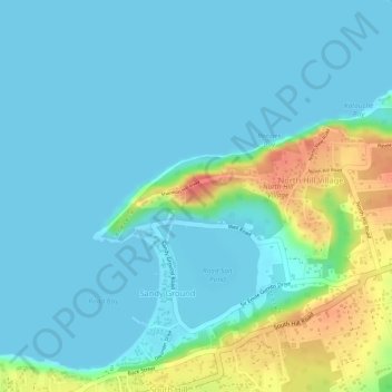
Name: North Hill topographic map, elevation, terrain.

Location: North Hill, AI2640, Anguilla (18.20644 -63.08810 18.20654 -63.08800)

Average elevation: 14 m

Minimum elevation: 0 m

Maximum elevation: 64 m

Other topographic maps

Click on a map to view its topography, its elevation and its terrain.

Sandy Ground

Anguilla > Sandy Ground

Sandy Ground, Anguilla

Average elevation: 20 m

Anguillita Island

Anguilla

Anguillita Island, Anguilla

Average elevation: 0 m

Maunday's Bay

Anguilla > Long Bay Village

Maunday's Bay, Firefly Lane, Long Bay Village, AI2640, Anguilla

Average elevation: 3 m

Anguilla Channel

Anguilla > Blowing Point

Anguilla Channel, Jeremiah Gumbs Highway, Blowing Point, AI-2640, Anguilla

Average elevation: 9 m