
Canillo topographic map
Interactive map
Click on the map to display elevation.
About this map
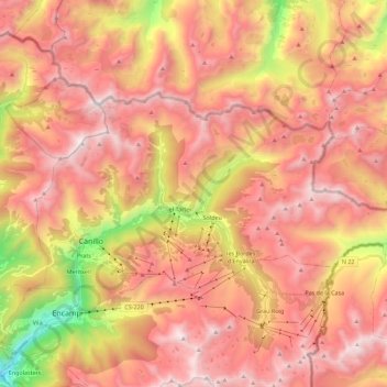
Name: Canillo topographic map, elevation, terrain.
Location: Canillo, AD100, Andorra (42.54356 1.56202 42.63032 1.78638)
Average elevation: 2,215 m
Minimum elevation: 1,124 m
Maximum elevation: 2,906 m
Other topographic maps
Click on a map to view its topography, its elevation and its terrain.