
Sungai Segget topographic map
Interactive map
Click on the map to display elevation.
About this map
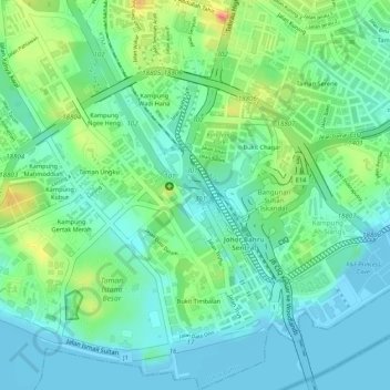
Name: Sungai Segget topographic map, elevation, terrain.
Location: Sungai Segget, Johor Bahru, Johor, 80730, Malaysia (1.46491 103.76100 1.46570 103.76160)
Average elevation: 20 m
Minimum elevation: -9 m
Maximum elevation: 60 m
Other topographic maps
Click on a map to view its topography, its elevation and its terrain.