
Lindside topographic map
Interactive map
Click on the map to display elevation.
About this map
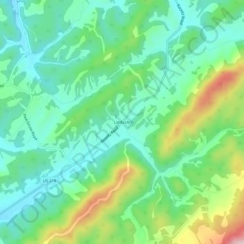
Name: Lindside topographic map, elevation, terrain.
Location: Lindside, Monroe County, West Virginia, United States (37.43373 -80.68979 37.47373 -80.64979)
Average elevation: 652 m
Minimum elevation: 567 m
Maximum elevation: 855 m
Other topographic maps
Click on a map to view its topography, its elevation and its terrain.