
Satun Province topographic map
Interactive map
Click on the map to display elevation.
About this map
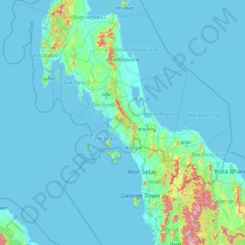
Name: Satun Province topographic map, elevation, terrain.
Location: Satun Province, Thailand (4.47667 97.40154 9.59667 102.52154)
Average elevation: 69 m
Minimum elevation: -2 m
Maximum elevation: 2,002 m