
Strümp topographic map
Interactive map
Click on the map to display elevation.
About this map
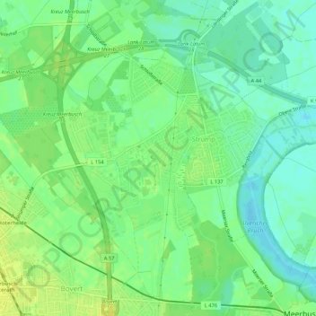
Name: Strümp topographic map, elevation, terrain.
Average elevation: 36 m
Minimum elevation: 27 m
Maximum elevation: 45 m
Das gesamte Ortsgebiet liegt auf einer Flussterrasse des Niederrheines (Niederrheinische Bucht) und ist sehr flach. Der sogenannte „Strümper Berg“ ist kaum merklich höher als das Umland.
Other topographic maps
Click on a map to view its topography, its elevation and its terrain.
Osterath
Deutschland > Nordrhein-Westfalen > Meerbusch
Osterath, Meerbusch, Rhein-Kreis Neuss, Nordrhein-Westfalen, 40670, Deutschland
Average elevation: 40 m
Latum
Deutschland > Nordrhein-Westfalen > Meerbusch
Latum, Lank-Latum, Meerbusch, Rhein-Kreis Neuss, Nordrhein-Westfalen, Deutschland
Average elevation: 33 m