
Sequoia National Forest topographic map
Interactive map
Click on the map to display elevation.
Sequoia National Forest
The Sequoia National Forest covers 1,193,315 acres (1,864.555 sq mi; 4,829.17 km2), and ranges in elevation from 1,000 feet (300 m) in the foothills of the Sierra Nevada to over 12,000 feet (3,700 m). Its giant sequoia (Sequoiadendron giganteum) groves are part of its 196,000 acres (790 km2) of old growth forests. Other tree species include.
About this map
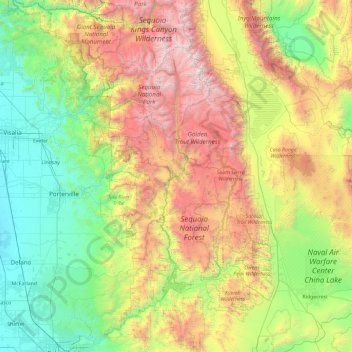
Name: Sequoia National Forest topographic map, elevation, terrain.
Average elevation: 1,331 m
Minimum elevation: 68 m
Maximum elevation: 4,288 m