
Sandy topographic map
Interactive map
Click on the map to display elevation.
About this map
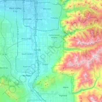
Name: Sandy topographic map, elevation, terrain.
Average elevation: 1,827 m
Minimum elevation: 1,291 m
Maximum elevation: 3,478 m
Other topographic maps
Click on a map to view its topography, its elevation and its terrain.
Canyon Village
United States of America > Utah > Sandy
Canyon Village, Sandy, Salt Lake County, Utah, 84094, United States of America
Average elevation: 1,459 m