
Skikda topographic map
Interactive map
Click on the map to display elevation.
About this map
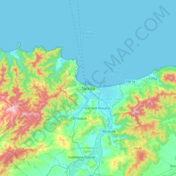
Name: Skikda topographic map, elevation, terrain.
Location: Skikda, Skikda District, Skikda, 21038, Algeria (36.71988 6.74749 37.03988 7.06749)
Average elevation: 125 m
Minimum elevation: -1 m
Maximum elevation: 671 m