
Adama topographic map
Click on the map to display elevation.
Adama
Adama (Oromo: Adaamaa or Hadaamaa), the city officially known as Adama formerly known as Nazret (ናዝሬት), is a city in central Oromia. Adama forms a Special Zone of Oromia and is surrounded by East shewa Zone. It is located at 8°32′N 39°16′E / 8.54°N 39.27°E / 8.54; 39.27 at an elevation of 1712 meters, 99 km southeast of Addis Ababa. The city sits between the base of an escarpment to the west, and the Great Rift Valley to the east.
About this map
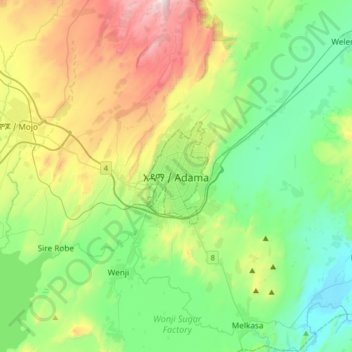
Name: Adama topographic map, elevation, terrain.
Location: Adama, Adama Special Zone, Oromia Region, 36, Ethiopia (8.38103 39.11055 8.70103 39.43055)
Average elevation: 1,673 m
Minimum elevation: 1,340 m
Maximum elevation: 2,447 m