
Klaffer am Hochficht topographic map
Interactive map
Click on the map to display elevation.
About this map
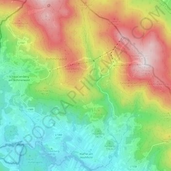
Name: Klaffer am Hochficht topographic map, elevation, terrain.
Location: Klaffer am Hochficht, Rohrbach, Upper Austria, 4163, Austria (48.68856 13.83129 48.76597 13.92633)
Average elevation: 879 m
Minimum elevation: 582 m
Maximum elevation: 1,327 m