
Hostie topographic map
Interactive map
Click on the map to display elevation.
About this map
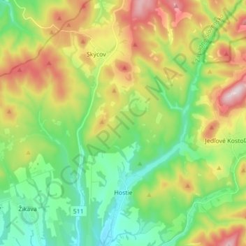
Name: Hostie topographic map, elevation, terrain.
Average elevation: 388 m
Minimum elevation: 217 m
Maximum elevation: 678 m
The municipality lies at an altitude of 290 metres and covers an area of 28.17 km². It has a population of about 1211 people.
Other topographic maps
Click on a map to view its topography, its elevation and its terrain.
Vieska nad Žitavou
Slovakia > Region of Nitra > District of Zlaté Moravce
Vieska nad Žitavou, District of Zlaté Moravce, Region of Nitra, Western Slovakia, 951 52, Slovakia
Average elevation: 179 m
Hostie
Slovakia > Region of Nitra > District of Zlaté Moravce > Hostie > Hostie
Hostie, District of Zlaté Moravce, Region of Nitra, Western Slovakia, 951 94, Slovakia
Average elevation: 296 m