
Uden topographic map
Interactive map
Click on the map to display elevation.
About this map
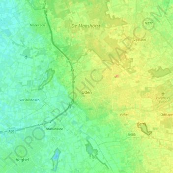
Name: Uden topographic map, elevation, terrain.
Location: Uden, North Brabant, Netherlands (51.62250 5.56197 51.70353 5.75048)
Average elevation: 16 m
Minimum elevation: 5 m
Maximum elevation: 29 m
Other topographic maps
Click on a map to view its topography, its elevation and its terrain.