
Driskill Mountain topographic map
Interactive map
Click on the map to display elevation.
Driskill Mountain
Driskill Mountain (also referred to as Mount Driskill) is the highest natural summit in Louisiana, with an elevation of 535 feet (163 m) above sea level. It lies about 5.3 miles (8.5 km) southeast of Bryceland, in Bienville Parish. A large pile of rocks marks the high point.
About this map
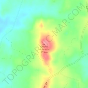
Name: Driskill Mountain topographic map, elevation, terrain.
Average elevation: 99 m
Minimum elevation: 66 m
Maximum elevation: 158 m
Other topographic maps
Click on a map to view its topography, its elevation and its terrain.
Bayou St. John
United States of America > Louisiana > New Orleans > Spanish Fort
Average elevation: 2 m