
Mount Fiji topographic map
Interactive map
Click on the map to display elevation.
About this map
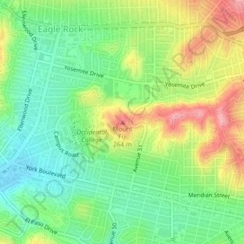
Name: Mount Fiji topographic map, elevation, terrain.
Average elevation: 191 m
Minimum elevation: 144 m
Maximum elevation: 260 m
Other topographic maps
Click on a map to view its topography, its elevation and its terrain.
Beilenson Park / Lake Balboa Park
United States of America > California > Los Angeles
Average elevation: 222 m