
Veredas de Maribeles topographic map
Interactive map
Click on the map to display elevation.
About this map
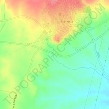
Name: Veredas de Maribeles topographic map, elevation, terrain.
Location: Veredas de Maribeles, Gerena, Sevilla, Andalusia, 41860, Spain (37.51114 -6.16956 37.53114 -6.14956)
Average elevation: 69 m
Minimum elevation: 37 m
Maximum elevation: 109 m
Other topographic maps
Click on a map to view its topography, its elevation and its terrain.
El Seroncillo
El Seroncillo, Gerena, Sevilla, Andalusia, Spain
Average elevation: 34 m