
Mount Lhotse topographic map
Interactive map
Click on the map to display elevation.
About this map
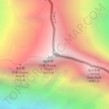
Name: Mount Lhotse topographic map, elevation, terrain.
Location: Mount Lhotse, Tingri County, Shigatse, Tibet, China (27.96159 86.93262 27.96169 86.93272)
Average elevation: 7,375 m
Minimum elevation: 5,713 m
Maximum elevation: 8,499 m
Other topographic maps
Click on a map to view its topography, its elevation and its terrain.
Island Peak
Nepal > Province #1 > Khumjung
Island Peak, Khumjung, Khumbupasanglahmu, Solukhumbu, Province #1, Nepal
Average elevation: 5,461 m