
McDonald topographic map
Interactive map
Click on the map to display elevation.
About this map
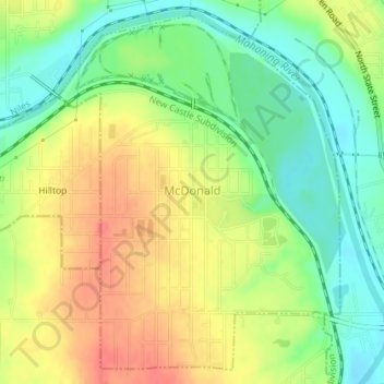
Name: McDonald topographic map, elevation, terrain.
Location: McDonald, Trumbull County, Ohio, 44437, United States (41.15102 -80.73680 41.17596 -80.71044)
Average elevation: 285 m
Minimum elevation: 255 m
Maximum elevation: 316 m
Other topographic maps
Click on a map to view its topography, its elevation and its terrain.