
Pound Ridge topographic map
Interactive map
Click on the map to display elevation.
About this map
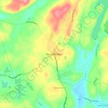
Name: Pound Ridge topographic map, elevation, terrain.
Average elevation: 163 m
Minimum elevation: 110 m
Maximum elevation: 232 m
Other topographic maps
Click on a map to view its topography, its elevation and its terrain.
Sarles Corners
United States of America > New York > Town of Pound Ridge > Pound Ridge > Sarles Corners
Sarles Corners, Pound Ridge, Town of Pound Ridge, Westchester, New York, 10576, United States of America
Average elevation: 141 m