
Zouk Mosbeh topographic map
Interactive map
Click on the map to display elevation.
About this map
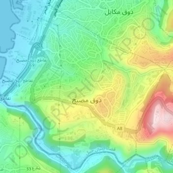
Name: Zouk Mosbeh topographic map, elevation, terrain.
Average elevation: 111 m
Minimum elevation: -1 m
Maximum elevation: 334 m
Zouk Mosbeh (Arabic: زوق مصبح) is a town and municipality in the Keserwan District of the Mount Lebanon Governorate in Lebanon. It is located 12 kilometers north of Beirut. Zouk Mosbeh's average elevation is 170 meters above sea level and its total land area is 453 hectares. Its inhabitants are predominantly Maronite Catholics and Christians from other denominations. There are three schools in the town, one public and two private, which together enrolled a total of 4,633 students in 2005–2006. There were 167 businesses with over five employees operating in Zouk Mosbeh as of 2006.