
Tilehurst topographic map
Interactive map
Click on the map to display elevation.
About this map
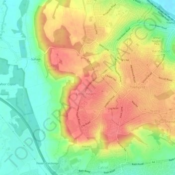
Name: Tilehurst topographic map, elevation, terrain.
Average elevation: 72 m
Minimum elevation: 36 m
Maximum elevation: 107 m
Other topographic maps
Click on a map to view its topography, its elevation and its terrain.
Sulham
United Kingdom > England > Sulham
Sulham, West Berkshire, South East, England, United Kingdom
Average elevation: 67 m