
Galtür topographic map
Interactive map
Click on the map to display elevation.
About this map
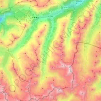
Name: Galtür topographic map, elevation, terrain.
Location: Galtür, Bezirk Landeck, 6563, Austria (46.84786 10.09783 46.99125 10.24947)
Average elevation: 2,355 m
Minimum elevation: 1,069 m
Maximum elevation: 3,365 m
Other topographic maps
Click on a map to view its topography, its elevation and its terrain.