
Make a donation
Gear up for your next adventure:
As an Amazon Associate, this site earns from qualifying purchases at no extra cost to you.
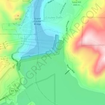
Grand Coulee Dam topographic map
Click on the map to display elevation.
Make a donation
Gear up for your next adventure:
As an Amazon Associate, this site earns from qualifying purchases at no extra cost to you.
Grand Coulee Dam
After power shortages in the Northwest during the 1960s, it was determined the six remaining planned pumps be pump-generators. When energy demand is high, the pump-generators can generate electricity with water from the Banks Lake feeder canal adjacent to the dam at a higher elevation. By 1973, the Pump-Generating Plant was completed and the first two generators (P/G-7 and P/G-8) were operational. In 1983, two more generators went online, and by January 1984 the final two were operational. The six pump-generators added 314 MW to the dam's capacity. In May 2009, the Pump-Generating Plant was officially renamed the John W. Keys III Pump-Generating Power Plant after John W. Keys III, the U.S. Bureau of Reclamation's commissioner from 2001 to 2006.
Make a donation
Gear up for your next adventure:
As an Amazon Associate, this site earns from qualifying purchases at no extra cost to you.
About this map
Name: Grand Coulee Dam topographic map, elevation, terrain.
Average elevation: 423 m
Minimum elevation: 291 m
Maximum elevation: 676 m
Make a donation
Gear up for your next adventure:
As an Amazon Associate, this site earns from qualifying purchases at no extra cost to you.