
Battambang topographic map
Interactive map
Click on the map to display elevation.
About this map
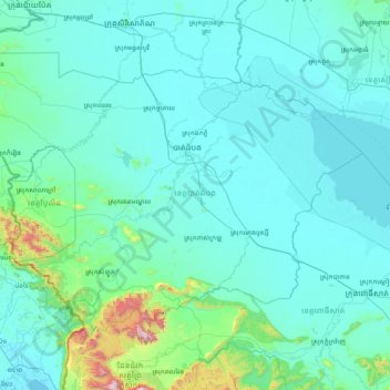
Name: Battambang topographic map, elevation, terrain.
Location: Battambang, Cambodia (12.37112 102.34508 13.47936 103.90117)
Average elevation: 99 m
Minimum elevation: 0 m
Maximum elevation: 1,610 m
Other topographic maps
Click on a map to view its topography, its elevation and its terrain.
Banan District
Banan District, Battambang, 020106, Cambodia
Average elevation: 37 m