
Bramhope topographic map
Interactive map
Click on the map to display elevation.
About this map
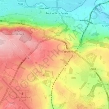
Name: Bramhope topographic map, elevation, terrain.
Location: Bramhope, Leeds, West Yorkshire, England, United Kingdom (53.87105 -1.66598 53.89738 -1.58330)
Average elevation: 143 m
Minimum elevation: 38 m
Maximum elevation: 249 m