
Avebury topographic map
Interactive map
Click on the map to display elevation.
About this map
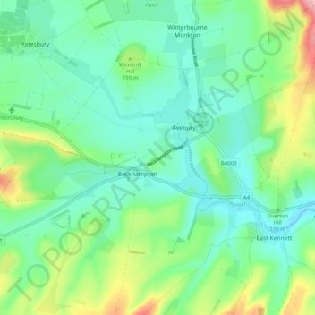
Name: Avebury topographic map, elevation, terrain.
Average elevation: 177 m
Minimum elevation: 142 m
Maximum elevation: 267 m
Other topographic maps
Click on a map to view its topography, its elevation and its terrain.
Silbury Hill
United Kingdom > England > Beckhampton
Silbury Hill, A4, Avebury Truslow, Avebury, Beckhampton, Wiltshire, South West England, England, SN8 1QL, United Kingdom
Average elevation: 166 m