
Tällberg topographic map
Interactive map
Click on the map to display elevation.
About this map
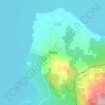
Name: Tällberg topographic map, elevation, terrain.
Location: Tällberg, Leksands kommun, Dalarna County, 793 70, Sweden (60.80564 14.97458 60.84564 15.01458)
Average elevation: 191 m
Minimum elevation: 159 m
Maximum elevation: 359 m
Other topographic maps
Click on a map to view its topography, its elevation and its terrain.