
Ferreira do Zêzere topographic map
Interactive map
Click on the map to display elevation.
About this map
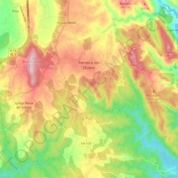
Name: Ferreira do Zêzere topographic map, elevation, terrain.
Location: Ferreira do Zêzere, Santarém, Médio Tejo, Centro, Portugal (39.64426 -8.30760 39.72159 -8.22542)
Average elevation: 274 m
Minimum elevation: 109 m
Maximum elevation: 440 m