
Hveragerði topographic map
Interactive map
Click on the map to display elevation.
About this map
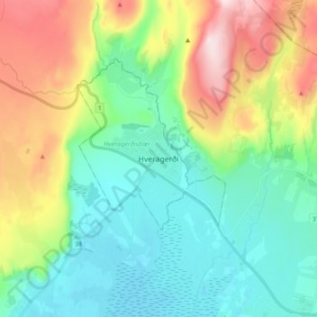
Name: Hveragerði topographic map, elevation, terrain.
Location: Hveragerði, Hveragerðisbær, Southern Region, 810, Iceland (63.95759 -21.22683 64.03759 -21.14683)
Average elevation: 144 m
Minimum elevation: -2 m
Maximum elevation: 467 m