
Portland topographic map
Interactive map
Click on the map to display elevation.
About this map
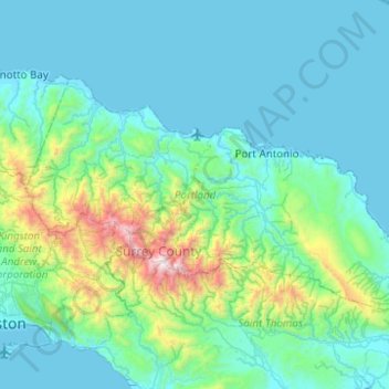
Name: Portland topographic map, elevation, terrain.
Location: Portland, Surrey County, Jamaica (17.98686 -76.75296 18.26681 -76.25798)
Average elevation: 297 m
Minimum elevation: 0 m
Maximum elevation: 2,230 m
Other topographic maps
Click on a map to view its topography, its elevation and its terrain.