
Lukomir topographic map
Interactive map
Click on the map to display elevation.
About this map
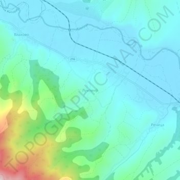
Name: Lukomir topographic map, elevation, terrain.
Average elevation: 310 m
Minimum elevation: 216 m
Maximum elevation: 722 m
Other topographic maps
Click on a map to view its topography, its elevation and its terrain.
Lukomir
Serbia > Central Serbia > Toplica Administrative District > Zitoradja Municipality
Average elevation: 328 m