
Loch Inch topographic map
Interactive map
Click on the map to display elevation.
About this map
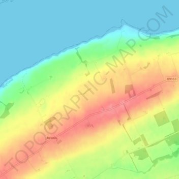
Name: Loch Inch topographic map, elevation, terrain.
Location: Loch Inch, Inverness, Highland, Scotland, United Kingdom (57.66411 -4.22487 57.66453 -4.22401)
Average elevation: 34 m
Minimum elevation: 0 m
Maximum elevation: 76 m
Scotland trails, hiking, mountain biking, running and outdoor activities
Other topographic maps
Click on a map to view its topography, its elevation and its terrain.