
Rhiwderin topographic map
Interactive map
Click on the map to display elevation.
About this map
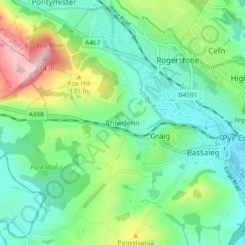
Name: Rhiwderin topographic map, elevation, terrain.
Location: Rhiwderin, Newport, Wales, NP10 8RN, United Kingdom (51.56144 -3.08920 51.60144 -3.04920)
Average elevation: 73 m
Minimum elevation: 16 m
Maximum elevation: 211 m
Wales trails, hiking, mountain biking, running and outdoor activities
Other topographic maps
Click on a map to view its topography, its elevation and its terrain.