
Sakib topographic map
Interactive map
Click on the map to display elevation.
About this map
Name: Sakib topographic map, elevation, terrain.
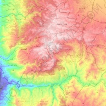
Average elevation: 639 m
Minimum elevation: -254 m
Maximum elevation: 1,244 m
Sakib is situated on the East Bank Plateau. Originally, the city had been built on Mountains. Sakib's terrain is typified by its mountains, and the area's elevation ranges from 900 to 1,200 m. Jerash is located to the east, Irbid io the north, Zarqa to the southeast and the capital Amman is to Sakib's south.
Other topographic maps
Click on a map to view its topography, its elevation and its terrain.
الحداده
Jordan > Jarash > Jerash Sub-District > الحداده
الحداده, Jerash Sub-District, Qasabah Jerash, Jarash, 26111, Jordan
Average elevation: 579 m