
Oak Hill topographic map
Interactive map
Click on the map to display elevation.
About this map
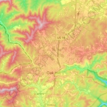
Name: Oak Hill topographic map, elevation, terrain.
Location: Oak Hill, Fayette County, West Virginia, United States (37.95898 -81.18758 38.02072 -81.06336)
Average elevation: 580 m
Minimum elevation: 364 m
Maximum elevation: 763 m
Other topographic maps
Click on a map to view its topography, its elevation and its terrain.