
Wadi Qattara Passage topographic map
Interactive map
Click on the map to display elevation.
About this map
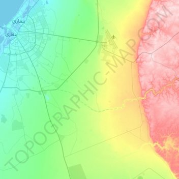
Name: Wadi Qattara Passage topographic map, elevation, terrain.
Location: Wadi Qattara Passage, Benghazi, 17016, Libya (31.97320 20.05719 32.04807 20.41839)
Average elevation: 111 m
Minimum elevation: -4 m
Maximum elevation: 316 m
Other topographic maps
Click on a map to view its topography, its elevation and its terrain.