
Kavaratti Island topographic map
Interactive map
Click on the map to display elevation.
Kavaratti Island
The island of Kavaratti lies 360 km (190 nmi) off the coast of the state of Kerala at 10°34′N 72°38′E / 10.57°N 72.64°E / 10.57; 72.64. It has an average elevation of 0 metres (0 feet).
About this map
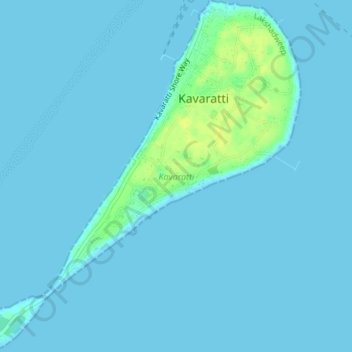
Name: Kavaratti Island topographic map, elevation, terrain.
Location: Kavaratti Island, Kavaratti, Lakshadweep, 262240, India (10.54073 72.61545 10.57747 72.64979)
Average elevation: 2 m
Minimum elevation: 0 m
Maximum elevation: 17 m