
Kemsley topographic map
Interactive map
Click on the map to display elevation.
About this map
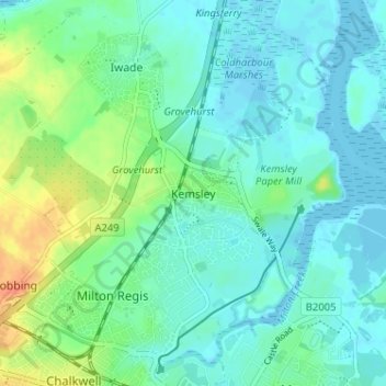
Name: Kemsley topographic map, elevation, terrain.
Location: Kemsley, Kent, South East, England, ME10 2RR, United Kingdom (51.34347 0.71905 51.38347 0.75905)
Average elevation: 10 m
Minimum elevation: -3 m
Maximum elevation: 39 m