
Nashik topographic map
Interactive map
Click on the map to display elevation.
About this map
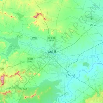
Name: Nashik topographic map, elevation, terrain.
Location: Nashik, Maharashtra, 422001, India (19.85125 73.63024 20.17125 73.95024)
Average elevation: 631 m
Minimum elevation: 535 m
Maximum elevation: 1,079 m
Other topographic maps
Click on a map to view its topography, its elevation and its terrain.
Pandav-Leni
India > Maharashtra > Nashik > Nashik > Pandav-Leni
Pandav-Leni, Nashik, Maharashtra, 422001, India
Average elevation: 646 m