
Al Madina topographic map
Interactive map
Click on the map to display elevation.
About this map
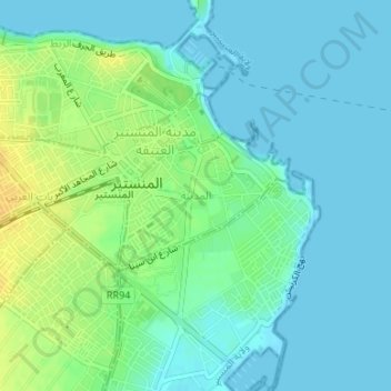
Name: Al Madina topographic map, elevation, terrain.
Location: Al Madina, Al Munastir, Monastir, Tunisia (35.76463 10.82650 35.77502 10.84104)
Average elevation: 8 m
Minimum elevation: -1 m
Maximum elevation: 26 m
Other topographic maps
Click on a map to view its topography, its elevation and its terrain.
Al Munastir
Tunisia > Monastir > Al Munastir
Al Munastir, باب الغربي, Al Munastir, Monastir, 5000, Tunisia
Average elevation: 11 m