
Arab topographic map
Interactive map
Click on the map to display elevation.
Arab
According to the U.S. Census Bureau, the city has a total area of 13.1 square miles (34.0 km2), of which 14.0 square miles (36.3 km2) is land and 0.12 square miles (0.3 km2), or 1.02%, is water. The town's elevation is 1,124 feet (343 m) above sea level.
About this map
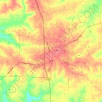
Name: Arab topographic map, elevation, terrain.
Location: Arab, Marshall County, Alabama, 35016, United States (34.28777 -86.56015 34.36571 -86.45000)
Average elevation: 314 m
Minimum elevation: 266 m
Maximum elevation: 343 m
Other topographic maps
Click on a map to view its topography, its elevation and its terrain.