Geolocate

Normal topographic map

Interactive map

Click on the map to display elevation.

About this map

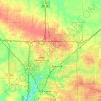
Name: Normal topographic map, elevation, terrain.

Location: Normal, McLean County, Illinois, United States (40.49383 -89.06045 40.56175 -88.90288)

Average elevation: 249 m

Minimum elevation: 220 m

Maximum elevation: 272 m

Other topographic maps

Click on a map to view its topography, its elevation and its terrain.

Bloomington

United States > Illinois > McLean County

Bloomington, McLean County, Illinois, United States

Average elevation: 246 m

Hudson

United States > Illinois > McLean County

Hudson, McLean County, Illinois, United States

Average elevation: 234 m

Towanda

United States > Illinois > McLean County

Towanda, McLean County, Illinois, 61776, United States

Average elevation: 239 m

Anchor

United States > Illinois > McLean County

Anchor, McLean County, Illinois, United States

Average elevation: 235 m